As the impacts of global climate change are increasing significantly, threatening the existence of the Earth’s inhabitants, the attention of many people has been focused on the Arctic and Antarctic polar regions. These are areas often discussed related to climate change.
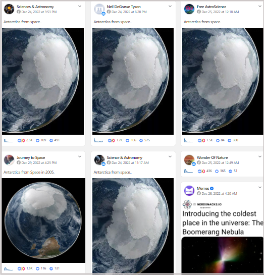
In such a background, a photo is once again viral on social networks, showing that Antarctica is almost entirely covered by substantial ice layers when observed from space, implying that the theories of ice melting by climate scientists are overly exaggerated.
Let’s look at the claim first.
Social Media Posts
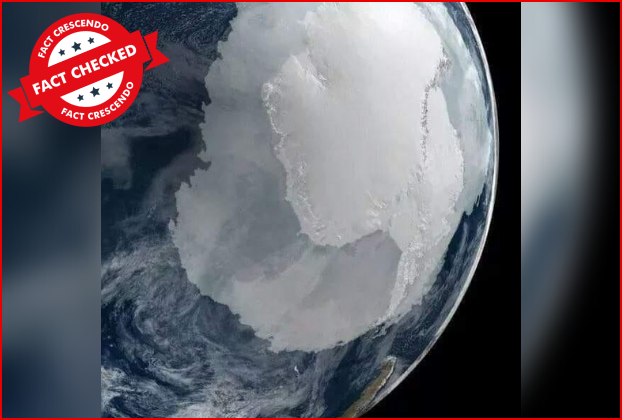
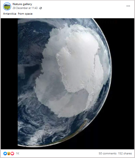
The social media posts are trying to convince the users that the below image depicts the aerial photograph of Antarctica taken from space.
Users commented on it like below.

These posts were viral on Facebook.
We decided to do a fact-check on this.
Fact Check
Using a reverse image search, we found out that the particular photo was a computer-generated illustration (CGI) made by NASA based on data from Earth-observing satellites. It can be seen on NASA’s Scientific Visualization Studio website.
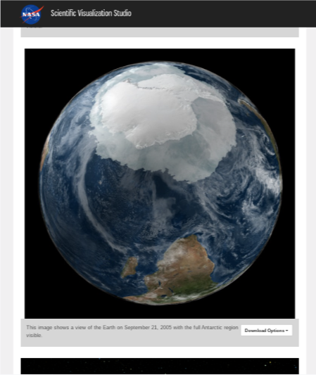
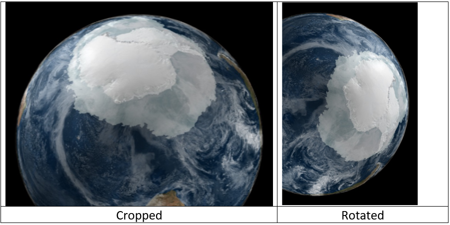
The visualisation was created by NASA engineer Cindy Starr and was released by NASA’s Scientific Visualization Studio in 2007. The viral photo seems to be the second in the illustration (cropped and rotated version).
We also found that the image was initially created to show ice extent in the Arctic and Antarctic regions. However, the data used to create the image is from September 2005, when ice cover in Antarctica would be at a maximum level that year.
This explains why the extensive ice cover in the photo seemed to be a disputable point for many climate change deniers to drive home their claim that global warming is not happening and climate change is not accurate.
Peter H. Jacobs, a climate scientist at NASA, told The Associated Press that AMSR-E, a microwave radiometer on NASA’s Aqua satellite, was used to create this visualization using sea ice data. He further said that data from the AMSR-E was used to determine the extent of the sea ice and its colour. AP article can be read here. Archived
Also, under the Climate Fact Checks, a project of Fact Crescendo, we have already published a detailed fact check to clarify how Antarctica is melting, which is quite alarming. We have also proven that it is accelerated because of human-induced global warming and climate change. It is also true that the melting of ice in the Antarctica region contributes to the rise in global sea levels, which has also been addressed in our fact check.
We found that “Antarctic Sea ice extent shows no clear long-term trend since 1979, but land ice of Antarctica is melting away at an increasing rate which is a major contributor to rising sea levels. East Antarctica seemed stable, but recent reports point to the fact that glaciers are rapidly melting in West Antarctica and East Antarctica, too, is witnessing rapid changes. The melting of glaciers in the Antarctic region contributes to the elevation of global sea levels.”
Read Complete Fact Check from here. Archived.
Follow us and stay up to date with our latest fact checks.
Facebook | Twitter |Instagram | Google News |TikTok
Conclusion
The photo in question is computer-generated imagery (CGI) produced by NASA. The data used to create the image was from the year (2005 September) when ice cover in Antarctica remained at the maximum level in that year. Also, the image does not depict the overall impression of the ice level during that period either, as only sea ice levels were considered in this imagery.
Studies have indicated that more than the sea ice shown in this image, the Antarctica region’s land ice is rapidly melting due to human-induced global warming impacts.

Title:Find out the Truth behind this recurring viral image claiming to be an image of Ice Cover in Antarctica seen from Space!
Fact Check By: Kalana KrishanthaResult: Misleading